From there we drove to a small village called Philleigh where we stopped at an Inn for a sandwich outside in the sun. We also explored the church behind the Inn and were lucky to be able to do this as the organist practiced. The graveyard is one that is managed by wildlife and as we entered through the gate we were greeted by a robin.
On from there we drove to Pendower Beach. The view from here was stunning as the beach sits in a large bay. Porthscatho sat glistening in the sun around the bay. The beach sits at the mouth of a valley and is sandy with small pebbles. As you walk along the beach it becomes backed by a cliff before the cliff drops away and it turns into Carne Beach. F skimmed stones into the sea and we admired the beach rocks. We spent quite a bit of time there....
We drove on to Porthscatho, a lovely little fishing village / town which is joined to Gerrans. I was amused to see a poster advertising a frog race!
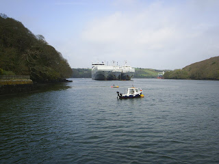
From there we drove on to the very end of the peninsula, St Anthony's Head. This headland is the southern most point of the peninsula and sits at the entrance of Carrick Roads. The Carrick Roads is the expanse of water where several flooded river valleys come together. The largest of these creeks is the Fal, to the west is the port of Falmouth which sits between Falmouth, Flushing and Penryn and the third is the smaller creek which flows past St Mawes and into the Roseland Peninsula. Carrick Roads is such a deep and wide channel that huge ships regularly pass through it to avail themselves of the docks services at Falmouth.
 From St Anthony's Head across Carrick Roads to Pendennis in Falmouth. You can just see the castle as the highest point on the headland. The docks are to the right of the headland.
To one side of the mouth sits St Anthony's Head and across the other side is the mound on which Pendennis Castle sits in Falmouth. A twin castle to Pendennis sits on the Roseland at St Mawes. Further military facilities sat on St Anthony's Head. A battery was sited on the head with an observation room for positioning ships. They were defended by the addition of walls. There was still ammunition and guns up there until 1959.
 View from St Anthony's Head looking towards St Mawes with the Fal passing St Mawes on the left.
 Walking between the battery walls.
At the bottom of the head there sits a lighthouse, St Anthony's Lighthouse. This lighthouse guides ships into Carrick Roads and warns them of the Black Rocks and the Manacles Reef. This lighthouse was the one used in the classic children's programme, Fraggle Rock. A little further along the coast is the old parafin store for the lighthouse.
 St Anthony's Lighthouse
From there we drove back up the peninsula, round the creek, to St Mawes. We walked along the sea front a ways and then drove up to St Mawes Castle.
I have seen so many beautiful views today and I have seen the Carrick Roads from so many angles. One last view of Carrick Roads from St Mawes Castle.
 One last view of Carrick Roads from St Mawes Castle.
On the map below, the Roseland is the landmass to the right, with St Anthony's at the very bottom.
View map of Falmouth, Cornwall, England, TR11 3 on Multimap.com
Get directions to or from Falmouth, Cornwall, England, TR11 3
Get directions to or from Falmouth, Cornwall, England, TR11 3


No comments:
Post a Comment